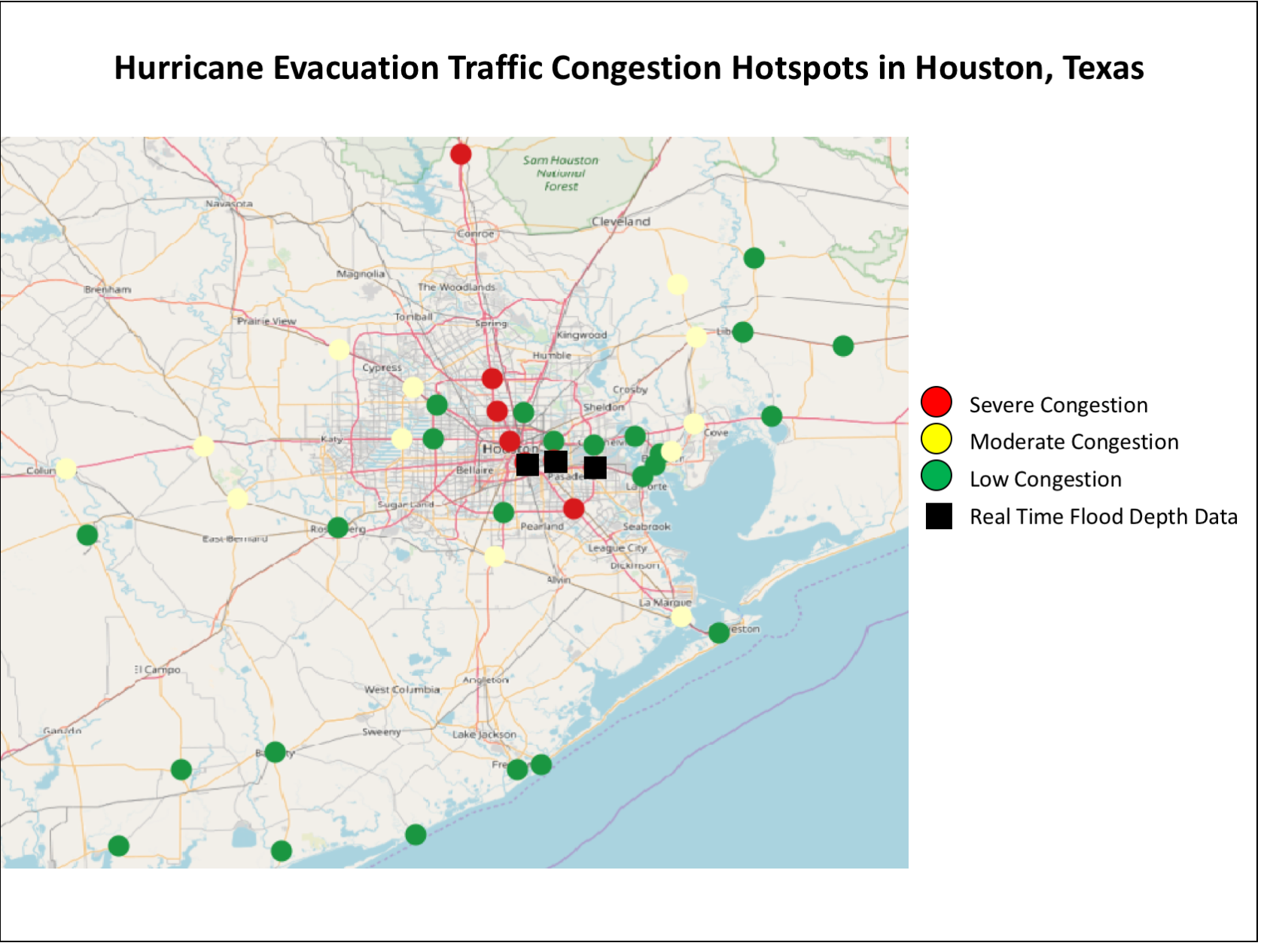
Emergency evacuations are essential for protecting people from hazardous events such as wildfires, tsunamis, hurricanes, industrial accidents, and terrorist actions. One way to assess the effectiveness of an evacuation plan is through mathematical models that represent the road topology, population characteristics, and hazard conditions of a specific geographic area. MPS GEOINT students Zachary Mostowsky and Ian Jonesi recent developed a new approach to modeling emergency evacuations as part of Lecturer Micah Brachman’s GEOINT Networks course. In this research, multiple geospatial datasets are incorporated into a network science model that can help predict traffic flows during an emergency evacuation. This model is applied to the Houston, Texas, metropolitan area to create maps showing where areas of traffic congestion may occur during a hurricane evacuation. The GEOINT research team plans to publish this research in the 2019 USGIF State and Future of GEOINT report, and will also present a poster at the 2019 AAG Annual Meeting. 
![]()