The MS GIS and GEOINT programs host the MS Capstone Symposium biannually, offering students a platform to present their capstone projects as the culmination of their graduate studies.
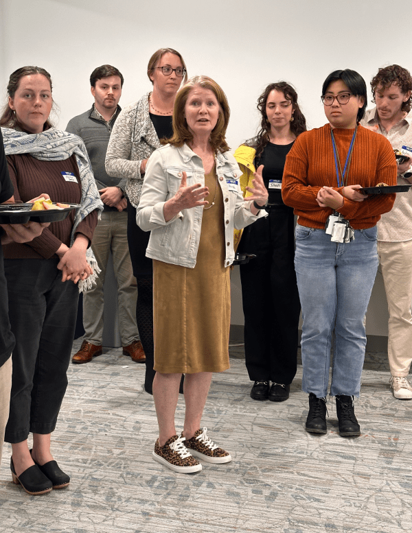
This fall’s symposium featured online lightning talks on Nov. 12 and an in-person poster session on Nov. 14. Ronda Schrenk, CEO of the United States Geospatial Intelligence Foundation (USGIF) attended as a special guest.
The symposium showcased a diverse range of student projects on topics related to the application of GIS, spatial analysis, modeling, remote sensing, data mining and more through independent research or design work.
Congratulations to all MS GIS and GEOINT fall graduates on earning their degrees!
View recordings of the online lightning talks, using passcode 2s!#yE.P.GrGr
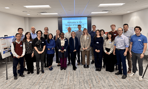
Faculty, staff and student presenters at the MS Programs Symposium.
Student Presenters on Nov. 12
|
Name |
Capstone Title |
|
Jennifer Epstein |
Stochastic River Flow Modeling Using Remote Sensing Data in the Pangani River Basin, Tanzania |
|
Wenchao Cao |
Evaluating the Geospatial Dynamics of China's Naval Base in Djibouti |
|
David Gunther |
A Novel Spatial Analysis Assessing Traffic Fatality Hot Spots in U.S. NationalParks |
|
James Walker |
Multiple Criteria Site Selection for Bioswales in the Ala Wai Watershed of Oahu, Hawaii |
|
Camellia Chang |
Agricultural Transformation: Insights from the Evidence for Resilient Agriculture (ERA) Dataset |
|
Taylor Miranda |
Predicting the Dynamic Surface Water Extent of the Saltese Flats Wetlands in Spokane County, Washington: A Web Application |
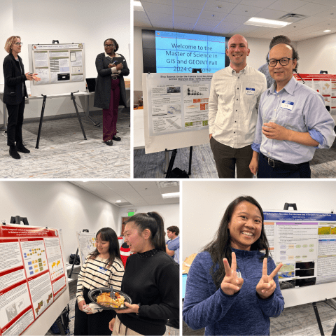
Faculty and student presenters
Student Presenters on Nov. 14
|
Name |
Capstone Title |
|
José Anza García |
A 3D Web GIS Application for Exploring and Managing a University Map Library |
|
Alice Benjamin |
Guinea School Accessibility: Using Walk Time to Primary and Secondary Schools to Determine Lowest Access Areas |
|
Sadie Cimino |
Spatial-Temporal Analysis of Cancer Consult Cases for Methylation-Based Diagnostic Testing |
|
Allison DeBoy |
Analyzing Pineapple Farming and its Effects on the Limón Province of Costa Rica |
|
Roxiel Dela Cerna |
Assessing Ecosystem Alterations Post-Hurricane Irma in Everglades National Park, Florida |
|
Ali Forghani |
Development of a GIS Application to Enhance Regional DEMs Using Lidar Data |
|
Sai Marri |
Evaluating Optimal Business Sites in Washington, D.C. through GIS Techniques |
|
Stephanie Wacker |
Post Fire Risk Mapping With Weighted Overlay Analysis: A Case Study of the 2018 Camp and 2020 Creek California Wildfires |
|
Karl Wagner |
Ship Speeds Under the Francis Scott Key Bridge and an Improved Ship Traffic Visualization Tool |
|
Jillian Rizzo |
Air Quality Assessment in Appalachian Communities Adjacent to Fossil Fuel Infrastructure |
|
David Stolfo |
Mapping Compliance: A Machine Learning Approach to Enforcing the EU Deforestation Regulation in Mato Grosso, Brazil |
|
Antoine Baggett |
Comparing Tropical Forest Loss Area Estimates of the Global Forest Change and Tropical Moist Forest Datasets (2000-2023) |
|
Numbi Lutebula |
Using GIS to Monitor Vegetative Transplantation Experiment |
|
Penpitcha Kuram |
Spatio-Temporal Analysis of Intra-Urban Heat Islands and pm2.5 Pollution in Relation To Land Use: A Case Study of Bangkok (2020-2024) |
Congratulations to all MS GIS and GEOINT fall graduates on earning their degrees!
Main photo: USGIF CEO Ronda Schrenk speaks to student presenters.