-
Operation Pangolin Launches to Save World’s Most Trafficked Wild Mammal

-
De Floriani Begins Term as IEEE Division VIII Director for 2023-24

-
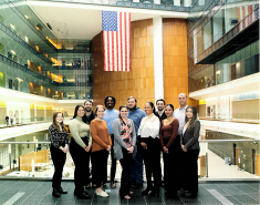
MS GEOINT Students Visit NGA Headquarters
-
CGIS Students Win Prestigious Prizes at 2022 ACM SIGSPATIAL Conference
-
Conservation Community Should Care About Violent Extremism, Urges GEOG Researcher

-
UMD Co-leads $750K NSF, Amazon Project to Tackle AI Bias in Mapping

-
UMD-Led Team Develops First-Ever Standards to Better Track, Manage Illegal Wildlife Trade

-
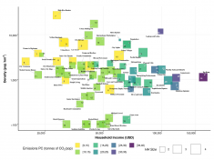
New Study Uses Geodemographic Data to Assess the Carbon Footprint of American Lifestyles
-
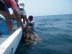
New Study Finds Sea Cucumber Trafficking Harms Ecosystems, Undermines Livelihoods