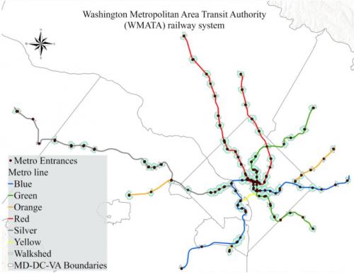
Researchers at the Center for Geospatial Information Science and the National Center for Smart Growth are working with the Washington Metropolitan Area Transit Authority (aka Metro) to model and predict transit ridership between stations as a function of land use, sociodemographic profiles, and urban infrastructure around each station. To incorporate micro-scale urban design indicators of walkability, the team is also collaborating with State of Place (SOP), a start-up that specializes in using automated data collection and artificial intelligence methods to foster more equitable communities. The team will use geospatial analytical techniques and machine learning approaches to enhance traditional ridership models and explore the factors that affect ridership. In addition, the constructed models will be used to capture how ridership demand may evolve in the future based on various levels of transit oriented urban development or the expansion of the transit system.